- All Posts
- blogs
- Cricket
- Delivery
- Logistics
- Sports
- Transport
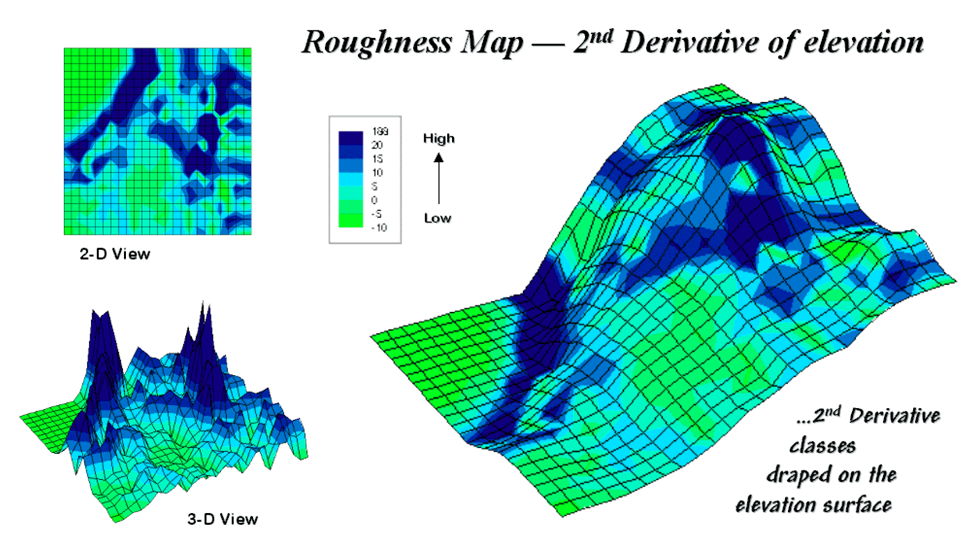
A Digital Elevation Model (DEM) is a representation of the bare ground topographic surface of the Earth?excluding trees, buildings, and...
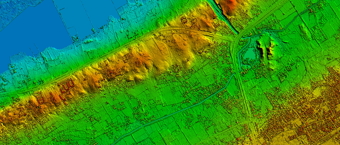
A digital elevation model is a bare-earth raster grid referenced to a vertical datum. The DEM can even be obtained from stereo digital aerial...