Digital Surface Model (DSM)
A Digital Surface Model (DSM) represents the elevation of the Earth’s surface including buildings, vegetation, and other structures. Unlike a Digital Terrain Model, which captures only bare ground, a DSM includes all surface objects, making it essential for urban modelling, telecom planning, infrastructure development, and geospatial analysis. Our high-resolution digital surface model data enables accurate 3D visualization and GIS-based terrain analysis.
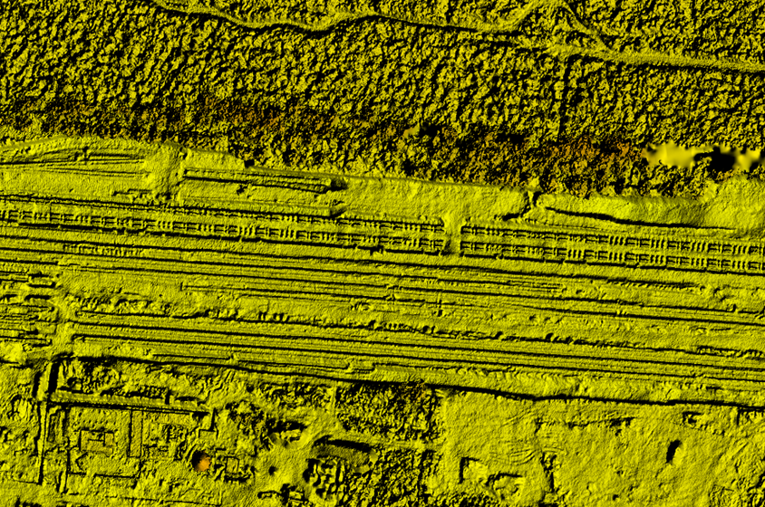
What is a Digital Surface Model (DSM)?
A Digital Surface Model (DSM) is a representation of the Earth’s surface that includes the elevation of natural and man-made features such as buildings, trees, and infrastructure. In geospatial analysis and GIS applications, DSM datasets provide detailed surface elevation information that is critical for urban modelling, line-of-sight analysis, and infrastructure planning.
Unlike a Digital Terrain Model (DTM), which represents the bare earth by removing surface objects, a DSM captures the true top surface of the landscape. This makes digital surface models especially valuable for applications that require understanding how structures interact with terrain.
Modern digital surface model data can be generated using satellite imagery, LiDAR, or interferometric SAR (IFSAR) technologies, providing highly accurate elevation datasets for 3D mapping, environmental monitoring, and geospatial intelligence.
Key Capabilities of Our Digital Surface Model
High-Resolution Surface Elevation Data
Our digital surface models provide precise elevation measurements that capture buildings, vegetation, and infrastructure, enabling accurate 3D terrain visualization and urban surface analysis.
Optimized for GIS and Geospatial Platforms
The DSM data integrates seamlessly with leading GIS platforms such as ArcGIS and other geospatial tools, allowing professionals to perform advanced spatial analysis and terrain modelling.
Ideal for Urban and Infrastructure Modelling
By representing real-world surface structures, digital surface models support smart city planning, infrastructure design, telecom network analysis, and urban development projects.
Global Coverage with Advanced Data Sources
Our digital surface model datasets can be derived from satellite imagery, LiDAR, and IFSAR technologies, enabling high-quality elevation data across large geographic regions.
Applications of Digital Surface Models
Urban Planning and Smart Cities
Digital surface models help planners analyze building heights, surface structures, and city layouts, supporting urban growth planning, zoning analysis, and smart city development.
Telecommunications and Line-of-Sight Analysis
Telecommunication companies rely on DSM datasets to evaluate terrain and building obstructions when planning cell towers, wireless networks, and communication infrastructure.
Renewable Energy Planning
For solar and wind energy projects, a digital surface model helps analyze terrain shading, surface obstacles, and optimal infrastructure placement.
Disaster Risk Assessment and Emergency Planning
DSM datasets enable detailed flood risk modelling, landslide assessment, and disaster response planning, helping authorities understand how terrain and surface structures impact hazard exposure.
Infrastructure and Engineering Projects
Engineers use digital surface models for road design, transportation planning, and construction analysis, ensuring accurate understanding of terrain and surface conditions.