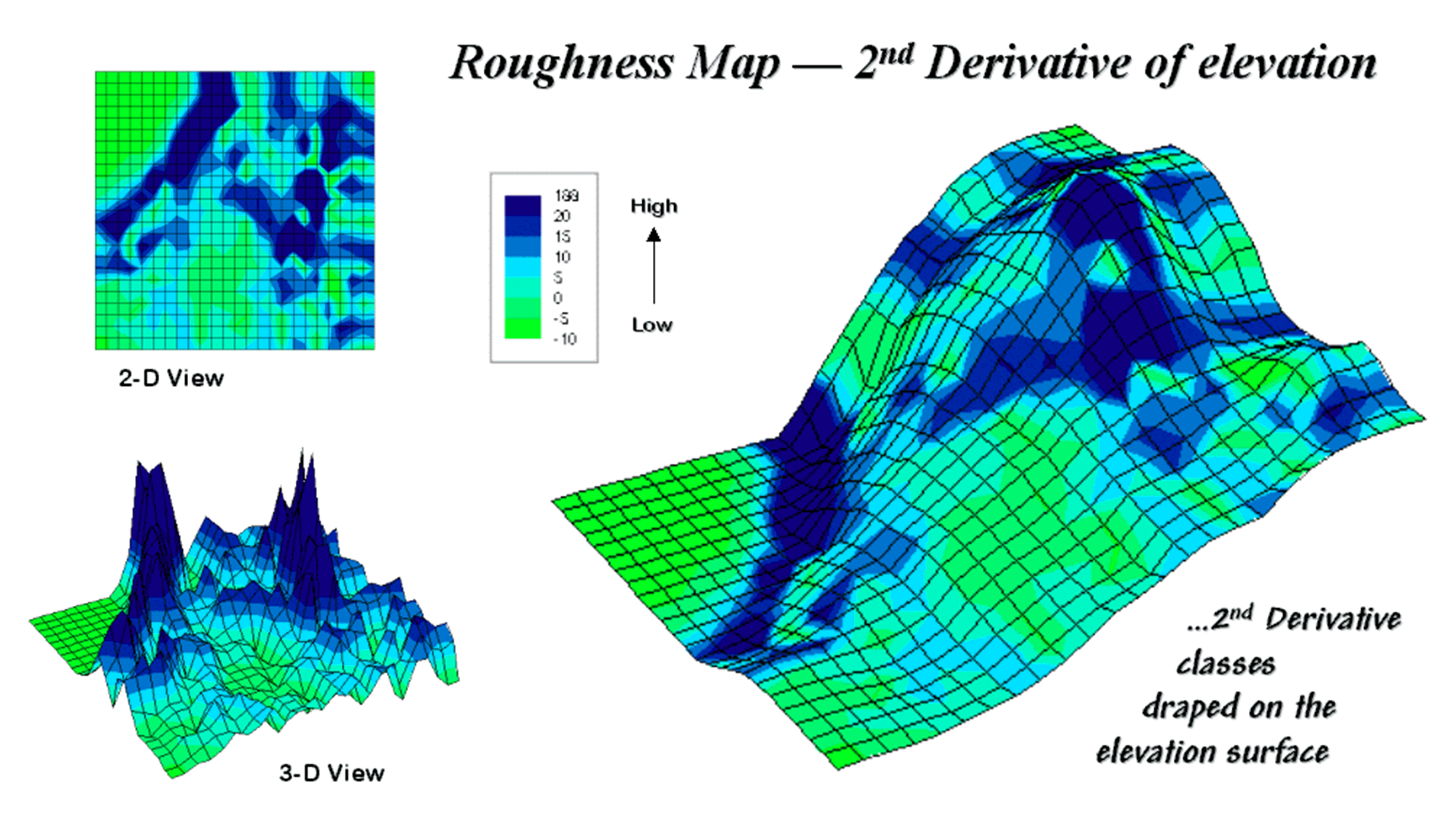
How 3D Landscape Models Simplify Complex Terrain Analysis
A team of geologists is tasked with assessing a landslide-prone mountain range. Traditional 2D maps provide an overview but lack crucial details such as subtle ridges or hidden valleys, which can lead to costly miscalculations. Landscape 3D models transform flat, outdated maps into interactive digital tools, replicating Earth's surface with