Digital Terrain Model (DTM)
A Digital Terrain Model (DTM) represents the bare-earth surface of the terrain by removing buildings, vegetation, and other surface objects. This makes a DTM digital terrain model ideal for applications that require precise terrain elevation data, including infrastructure planning, hydrological analysis, engineering design, and advanced GIS-based terrain modelling.
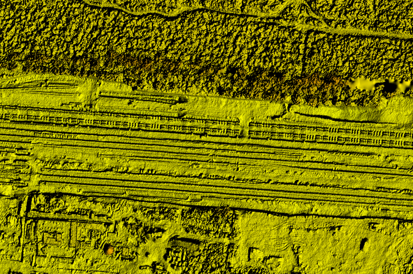
What is a Digital Terrain Model (DTM)?
A Digital Terrain Model (DTM) is a detailed representation of the Earth’s bare surface that captures terrain elevation without surface objects such as buildings or vegetation. In geospatial analysis and GIS applications, a digital terrain model provides accurate elevation data that supports terrain analysis, engineering design, and environmental modelling.
Unlike a Digital Surface Model (DSM), which includes structures and vegetation, a DTM digital terrain model represents only the ground surface. This makes it particularly valuable for projects that require understanding natural landforms such as slopes, valleys, and drainage patterns.
Modern digital terrain models are generated using technologies such as LiDAR, satellite imagery, and photogrammetry, enabling high-resolution terrain datasets for applications like road alignment, construction planning, flood modelling, and landscape analysis. By providing precise terrain elevation data, DTMs enable planners, engineers, and geospatial professionals to make more informed decisions.
Key Capabilities of Our Digital Terrain Model
High-Accuracy Bare Earth Representation
Our digital terrain models capture precise ground elevation by removing buildings and vegetation, providing reliable terrain elevation data for engineering and GIS analysis.
Optimized for GIS and Mapping Platforms
The DTM datasets are fully compatible with major GIS platforms such as ArcGIS and other geospatial tools, enabling seamless integration into mapping and terrain analysis workflows.
Ideal for Infrastructure and Engineering Projects
A digital terrain model supports projects such as road design, pipeline routing, construction planning, and transportation infrastructure development.
Generated from Advanced Remote Sensing Technologies
Our DTM data can be derived from LiDAR digital terrain models, satellite imagery, and photogrammetry, ensuring reliable and high-resolution terrain modelling.
Applications of Digital Terrain Models
Infrastructure Planning and Engineering
A digital terrain model is widely used for road alignment, railway design, pipeline routing, and construction planning, providing accurate terrain elevation for engineering projects.
Hydrological and Watershed Analysis
DTMs enable precise watershed modelling, flood analysis, and drainage network mapping, helping hydrologists understand water flow across terrain.
Environmental and Land Management
With accurate terrain elevation data, environmental scientists can analyze landforms, monitor ecosystem changes, and support sustainable land-use planning.
Mining and Resource Exploration
Mining companies rely on digital terrain models to analyze terrain slopes, assess excavation areas, and plan safe and efficient extraction operations.
Disaster Risk Assessment
DTMs help model landslides, flood zones, and terrain instability, enabling governments and organizations to plan disaster mitigation and emergency response strategies.