

Digital Surface Model
Digital Surface Model
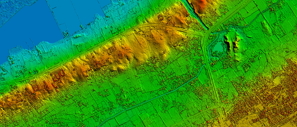
Digital Surface Model (DSM) represents the elevations of the reflective surfaces of trees, buildings, and other features elevated above the “Bare Earth”. It represents the earth’s surface and includes all objects on it.
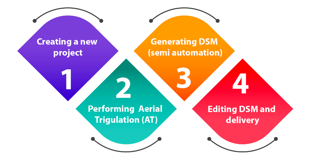
We use algorithm-based high-end software that is patented to end-to-end photogrammetry solutions for the generation of high-quality geospatial data from satellite and aerial imagery, including UAVs. It builds on unique computer vision algorithms that significantly differ from traditional photogrammetry techniques. Powered by GPU technology and multi-core CPUs, it ensures matchless processing power to support the rapid production of large datasets.
Key Features of the product
- Automatic execution of the data with a defined workflow
- GCP File Creation: a semi-automatic tool for creating and editing GCPs
- Change Detection: identification of 3D changes
- Stitching of DSM patches
- DSM Inspection: generation of statistics about DSM quality
- Point Cloud Colorization: colorization of a point cloud using a mosaic
- Simple and user-friendly interface
- An unlimited number of images can be processed
- Survey-grade accuracy with detailed reports
- Fast processing on GPUs and multi-core CPUs
- Volume Calculation
Applications of a DSM
These models are used in planning, analysis, visualization, and modeling.
- Urban planning, architectural planning, tourism, virtual tours, etc.
- For improving the transportation system
- Telecommunication
- Flood risk analysis and many others.
- Runway Approach Zone Encroachment: DSMs in aviation can detect runway obstructions in the approach zone.
- Vegetation Monitoring: DSMs can identify where and how much vegetation is intruding on a transmission line.
- View Obstruction: DSM is being used by urban planners to evaluate how a proposed building will affect the viewsheds of businesses and residents.
Documents

3D Landscape
Brochure