

Digital Terrain Model
Digital Terrain Model
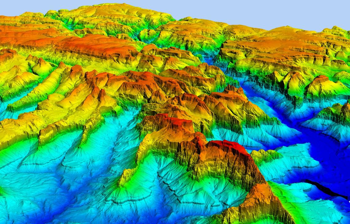
Digital Terrain Model (DTM) is a bare earth model that is generated using stereo pair of imageries. Such models become an integral part of topographic surveys. These models are also used to generate contour maps. Such models are the best depiction of slopes and aspects.
Digital Terrain Models (DTM) sometimes called Digital Elevation Models (DEM) is a topographic model of the bare Earth that can be manipulated by computer programs. The data files contain the elevation data of the terrain in a digital format that relates to a rectangular grid. Vegetation, buildings, and other cultural features are removed digitally – leaving just the underlying terrain.
How the product is unique?
- Next-generation global 3D terrain datasets
- Seamless data up to sub-meter post spacing
- Precise topographic analysis
- Comprehensive worldwide offering
- Hydro-enforced – water bodies and coastlines are flattened for accurate measurement
- Vintage: most recent or new collected imagery
- File format: GeoTIFF or other formats on request
- Post Spacing: 50cm to 10m
Inputs Required
- Stereo remote sensing imagery
- Ground Control Points (GCPs).
- Contours
- Triangulate Irregular Network (TIN).
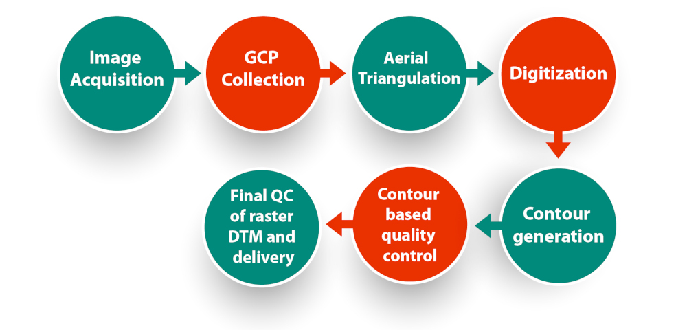
Workflow
Accuracy
- Absolute: 50cm to 5m (LE90)
- Valid on all-terrain type
Quality of the DTM
DTM is a measurement of how precise the elevation at each pixel is (absolute accuracy) and how precisely the morphology is presented (relative accuracy). So many factors have an impact on the quality of DTM:
- Terrain roughness
- Extracting terrain parameters
- Sampling density (elevation data collection method)
- Grid resolution or pixel size
- Interpolation algorithm
- Vertical resolution
- Terrain analysis algorithm
- Rendering of 3D visualizations
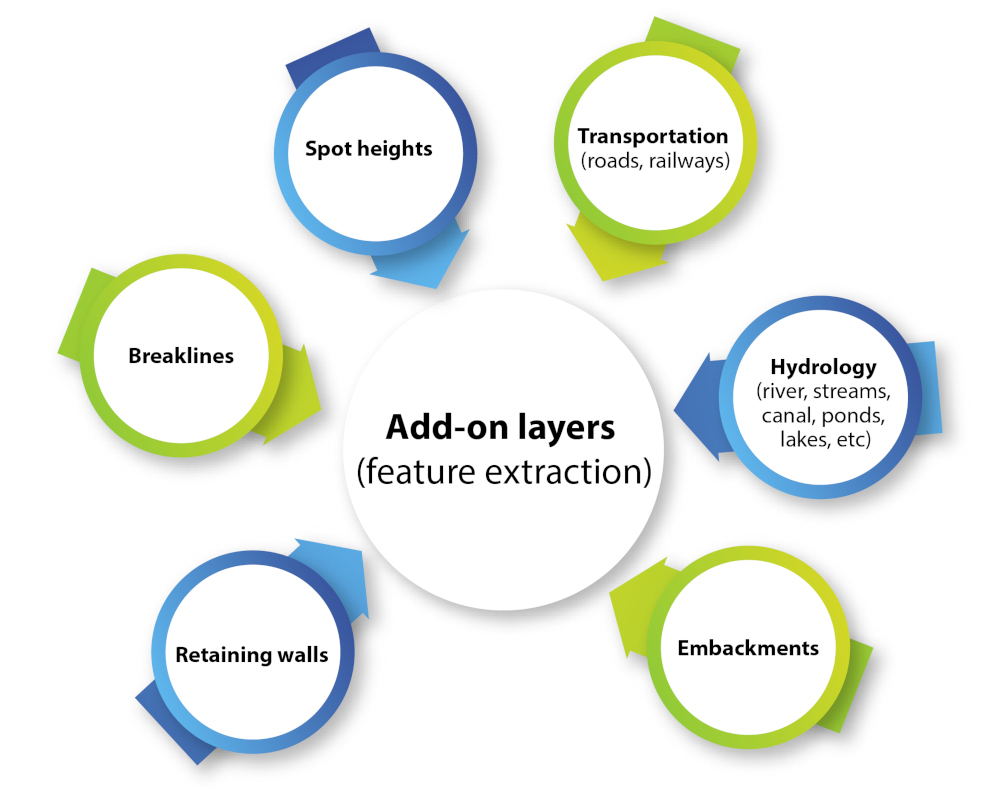
Add-on layers (feature extraction)
Application
- DTMs are used especially in civil engineering, geodesy & surveying, geophysics, geography, and remote sensing.
- Hydrology modeling
- Flood analysis
- Irrigation
- Feasibility study in infrastructure projects
- An essential part of a topographic survey
- Volume estimation in mining
- Input for orthorectification and many other
Documents

3D Landscape
Brochure