
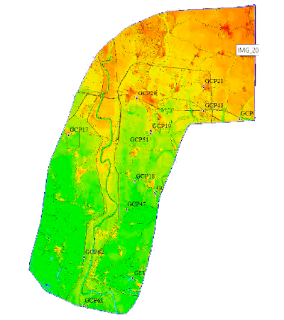
DTM For Hydrological Studies
DTM For Hydrological Studies
This project is a perfect case of using geospatial technology for hydrological studies. The output we delivered is used in irrigation, flood management, and other water resource management programs.
Scope of the work:
- Acquisition of satellite imagery
- DGPS survey
- DTM generation
- Generating contour map
Deliverables:
- 50cm ortho-ready Imagery from WorldView-2 satellite.
- DGPS detailed survey report.
- DTM with 1m grid spacing raster data (TIFF).
- Contour map with 1m interval (DWG).
Area Covered: 2704.3 sq. km
All Case Studies
Testimonials
What People Says About us
PeopleClients
Companies who Trust us
Clients